 Close System Requirement Details
Autodesk AutoCAD Map 3D 2024
Our model-based GIS mapping software provides access to CAD and GIS data to support planning, design, and management.
Autodesk AutoCAD Map 3D 2024
- Available: Electronic Delivery
- Brand: AutoDesk
- OS: Windows
Language: English, 中文, 日本語
Our model-based GIS mapping software provides access to CAD and GIS data to support planning, design, and management.
- System Requirements
Today's Price:
$1,599.00
$3,999.00
Quantity
Need a Quick Support for your Products,
CALL TOLL FREE
+1 424-644-6043
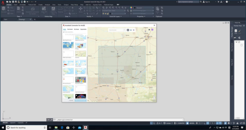
Watch the Autodesk AutoCAD Map 3D 2024 Overview Video


Why should I Buy Autodesk AutoCAD Map 3D 2024?
The 2024 Map 3D toolset is included with AutoCAD
Our model-based GIS mapping software provides access to CAD and GIS data to support planning, design, and management. With the Map 3D toolset, you can:
Directly access spatial data using Feature Data Objects (FDO) technologyDirectly edit geospatial dataManage infrastructure systems with Enterprise Industry Models
Directly access spatial data using Feature Data Objects (FDO) technologyDirectly edit geospatial dataManage infrastructure systems with Enterprise Industry Models
Map 3D toolset features
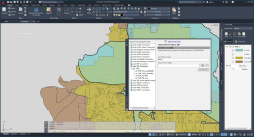 Use Feature Data Objects (FDO) technology
Work with spatial data from a variety of CAD and GIS data formats and coordinate systems.
 Connect to ArcGIS
Streamline the flow of data between ArcGIS and Map 3D and keep features information up to date.
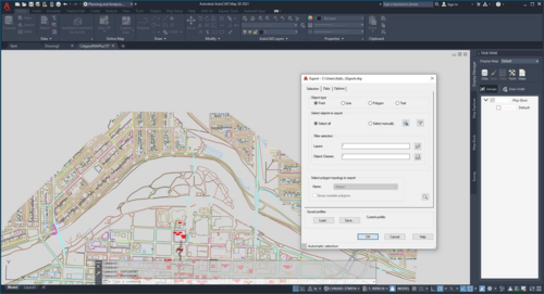 Convert data between DWG and GIS data
Perform high-fidelity data conversions using MapImport and MapExport.
 Edit geospatial data directly
Edit data against GIS data sources, such as ESRI SHP, MapInfo, and Oracle with standard AutoCAD commands.
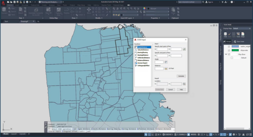 Apply coordinate geometry
Use coordinate geometry (COGO) input commands to enter accurate geometry when creating objects.
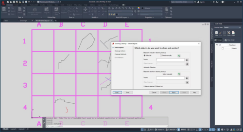 Run drawing cleanup actions
Use drawing cleanup to automate time-consuming corrections for common drafting and digitizing errors.
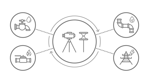 Use enterprise industry modules
Use intelligent application modules to efficiently manage a wide variety of infrastructure systems.
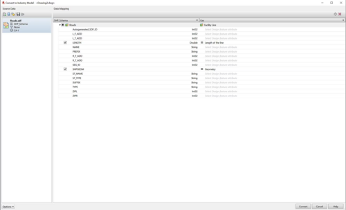 Convert data to intelligent industry models
Create and manage intelligent industry models by converting GIS data.
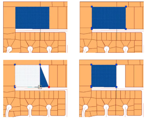
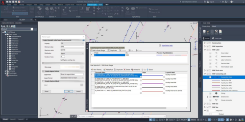 Apply styling and theming
Easily update styling using the style editor and use themes to display data to indicate different values.
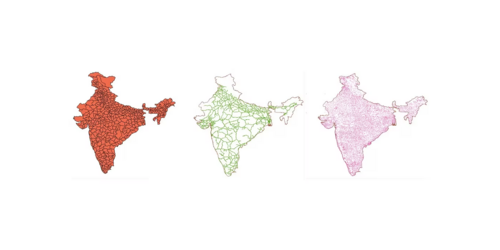 Build topologies
Create topologies to perform useful calculations, such as identifying customers downstream from a faulty pump.
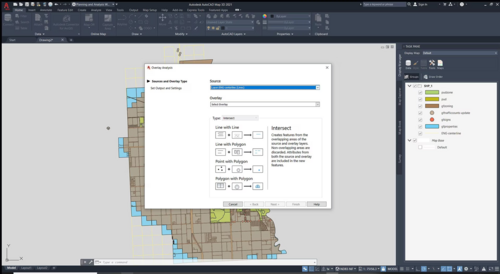 Analyze data with tools
Use robust functionalities, including buffers, overlay, and spatial queries, to analyze data.
Testimonials


DELIVERY
Instantly as electronic download

GUARANTEE
30 Days money back guaranteed

24/7 SUPPORT
Call Toll free 
Recently Viewed


X